How GPR and UAV Mapping Can Transform Heritage Projects
Heritage is not just what we can see on the surface – it is layered, complex, and often hidden. At Up & Under Services, our recent work at the University of Wollongong Health and Wellbeing Precinct demonstrates how integrating ground-penetrating radar (GPR) with uncrewed aerial vehicle (UAV) mapping can unlock a far richer understanding of heritage landscapes without the need for invasive excavation. The site itself carries deep cultural significance, associated with historical events including the Battle of Fairy Meadow (c. 1830–1835). The project aimed to assess whether subsurface cultural features, including potential burials, remained intact beneath a landscape heavily influenced by past construction and modern development. In contexts like this, traditional surface-based assessment methods are inherently limited, and a multi-layered, non-invasive approach becomes essential.
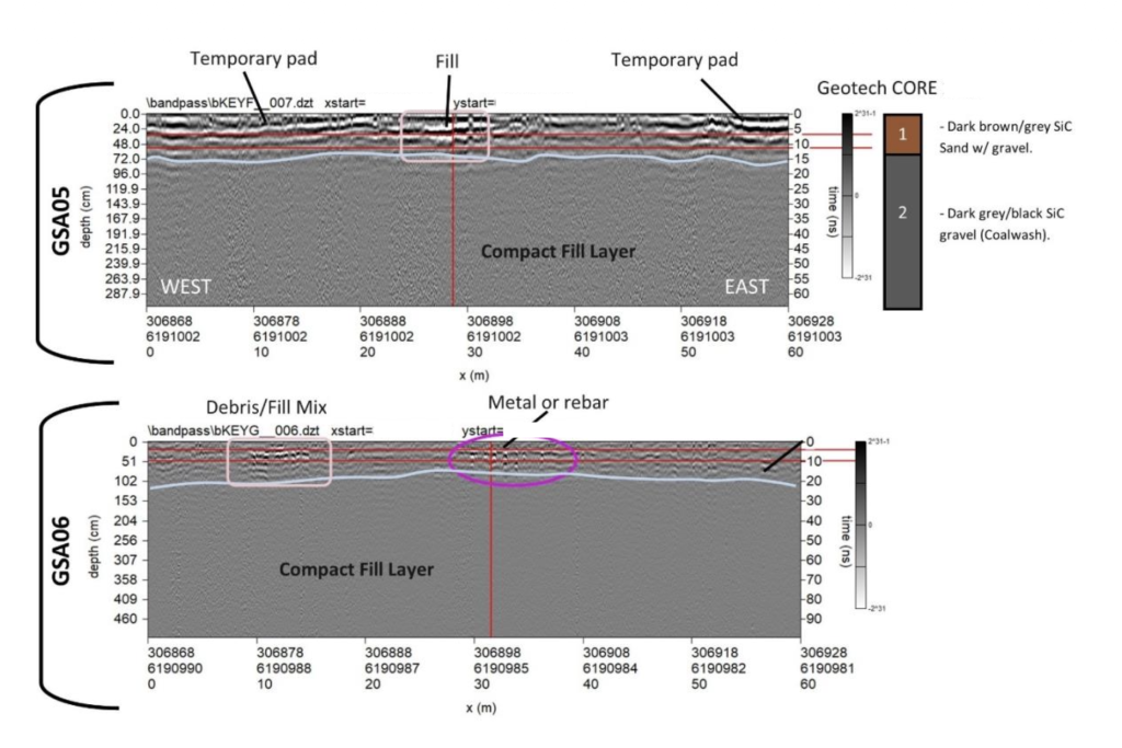
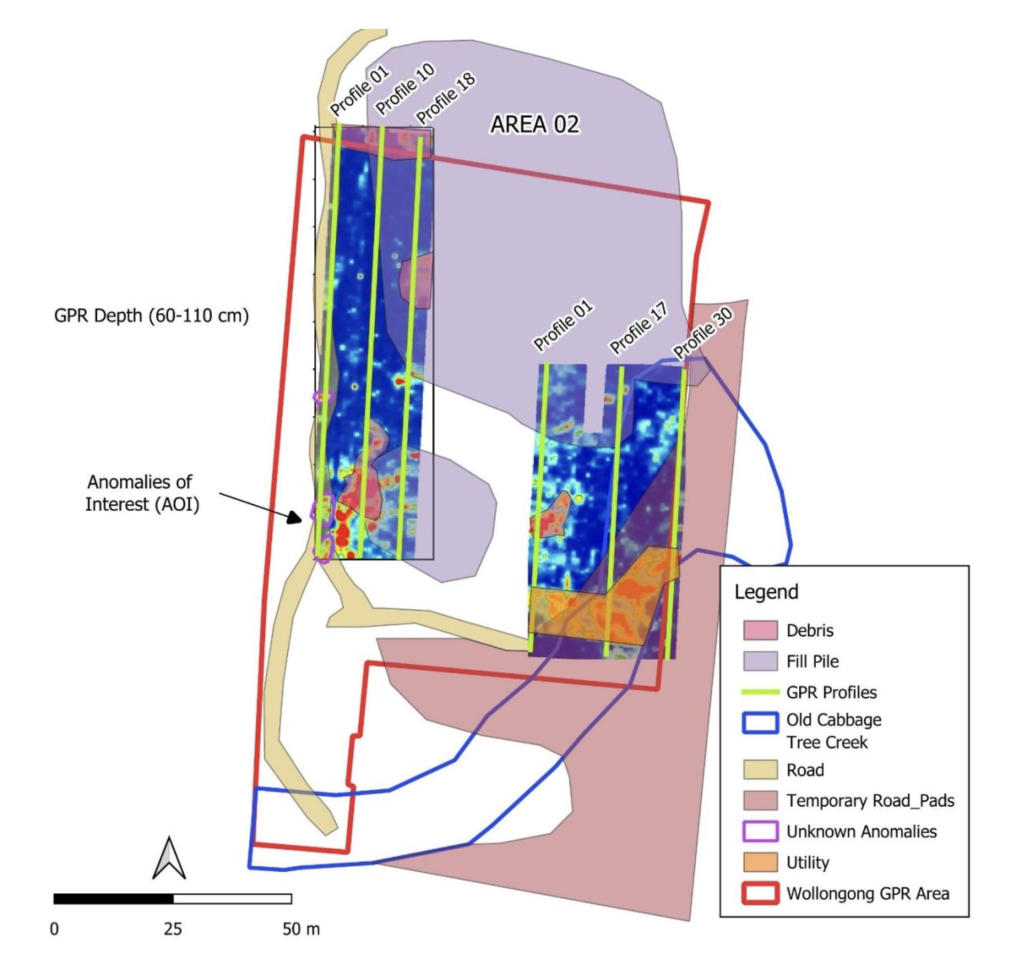
Ground-penetrating radar allowed us to investigate the subsurface in detail, identifying variations in soil composition, areas of disturbance, and anomalies that may represent archaeological or cultural features. The survey revealed complex stratigraphy across the site, including compact fill layers, former construction zones, and numerous high-amplitude reflections associated with utilities and buried debris. Notably, distinct clusters of large hyperbolic reflections were identified at depths of approximately 1 to 3.3 metres, representing key anomalies of interest for further investigation. While no burials were confirmed within the surveyed areas, the results significantly advanced understanding of the subsurface environment, demonstrating how geophysical data can refine archaeological questions, guide targeted investigation, and reduce uncertainty in heritage assessments.
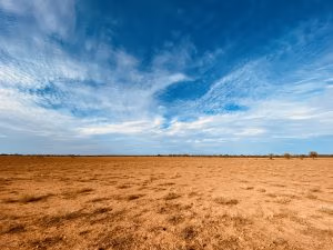
Complementing this, UAV-based aerial mapping provided critical landscape context, capturing high-resolution imagery and generating detailed digital elevation models across the site. This approach enabled rapid and efficient coverage of large areas while minimising disturbance, which is particularly important in culturally sensitive environments. The aerial data allowed for the identification of subtle topographic features, remnants of historical land use, and broader patterns of landscape modification that are not easily discernible from ground level. As outlined in the project, UAV mapping supports both immediate interpretation and longer-term research by enabling the creation of accurate 2D and 3D models that can be shared across project teams and used to visualise landscape evolution over time.
The true value of this work lies in the integration of these datasets. By combining GPR-derived subsurface information with UAV-derived surface and topographic data, we were able to correlate anomalies with visible landscape features, distinguish between natural geological variation and anthropogenic disturbance, and produce fully georeferenced outputs suitable for direct use in GIS environments. This integrated approach provides heritage consultants, planners, and stakeholders with a far more comprehensive evidence base, supporting informed decision-making and more effective management strategies. Importantly, all of this was achieved without excavation, reducing risk to potential cultural heritage while still delivering meaningful and actionable insights.
Projects like Wollongong highlight a shift in how heritage investigations are being approached. Rather than relying solely on traditional methods, there is increasing recognition of the value of non-invasive technologies that can provide depth, context, and clarity simultaneously. At Up & Under Services, we see GPR and UAV mapping not as supplementary tools, but as essential components of modern heritage practice – enabling a more nuanced understanding of sites and supporting better outcomes for both heritage protection and project delivery.
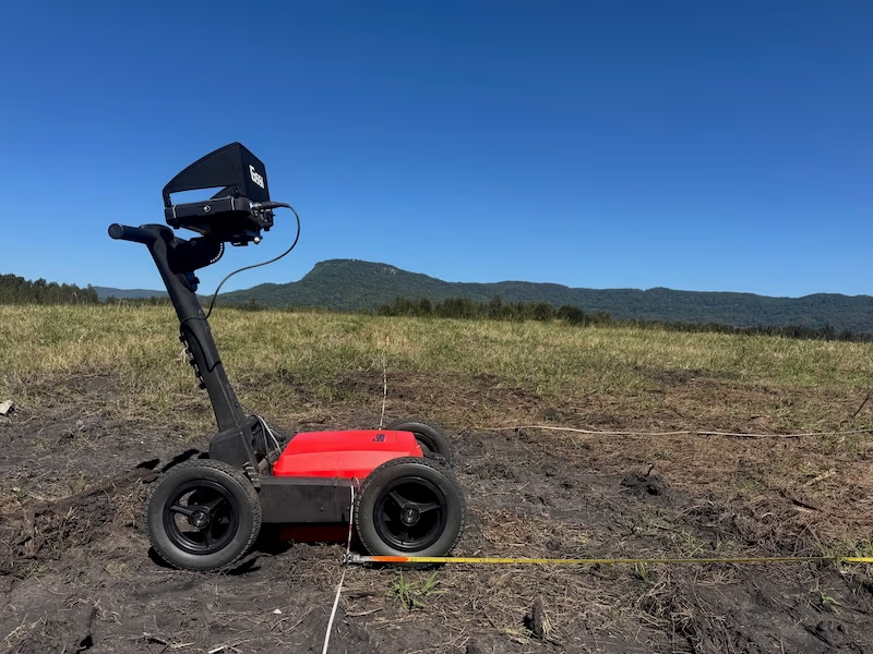
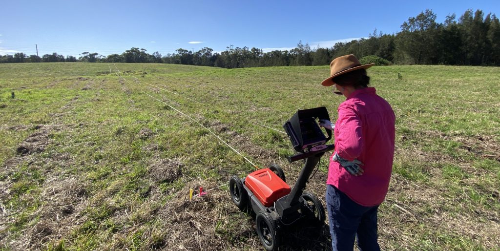
Geophysical (GPR) field works conducted by Dr Kelsey Lowe.
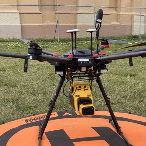
Aerial mapping conducted by Brad Arsenault, CRP.