Unmanned Aerial Vehicles (UAVs) or drones have revolutionised many industries, including mapping and surveying. These aerial vehicles offer a range of benefits over traditional mapping techniques, making them an attractive option for mapping projects of all sizes. In this article, we’ll explore the benefits of using UAV technology for mapping.
High-Quality Data Collection
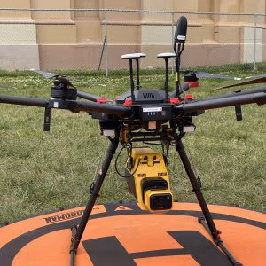
UAV technology has significantly improved data collection for mapping projects. The high-resolution cameras and sensors used in modern drones capture accurate and detailed images of the terrain, producing highly precise and detailed maps. The data collected from UAVs is also easily accessible and can be used for various applications, such as land-use planning, urban development, environmental monitoring, and natural disaster response.
Reduced Cost and Time
Using UAVs for mapping projects can significantly reduce both the cost and time required for data collection. Traditionally, data collection for mapping projects involved hiring survey teams, which was expensive and time-consuming. UAVs can cover large areas in a fraction of the time it takes for traditional methods, reducing the overall cost of the project. Drones can also operate in harsh and dangerous environments, such as mines and construction sites, eliminating the need for human survey teams, which further reduces costs.
Improved Safety
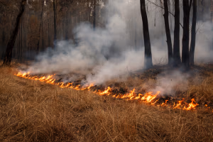
UAV technology has also improved safety in mapping projects. Traditionally, surveying teams had to work in hazardous environments, such as high altitudes, steep slopes, and rough terrain, putting them at risk of injury or death. Using UAVs eliminates the need for human survey teams to work in these dangerous environments, making the process safer and reducing the risk of accidents and injuries.
Flexibility
UAVs offer a high degree of flexibility, making them ideal for mapping projects of all sizes and types. They can be used for mapping large areas, such as cities, as well as small and complex areas, such as construction sites and quarries. Drones can also fly at varying altitudes, providing a different perspective on the terrain, which can be useful for different types of mapping projects.
Real-Time Monitoring
UAVs can provide real-time monitoring of a project site, allowing for immediate analysis of the data collected. This real-time monitoring can be used to identify potential issues, such as changes in the terrain or unexpected environmental impacts, which can be quickly addressed. This can save time and money by allowing for early identification of problems and prompt corrective action.
Environmental Benefits
UAV technology can also provide environmental benefits. Traditional surveying methods often involved cutting down trees and clearing land to access the terrain, which can have negative environmental impacts. UAVs can fly over the terrain without causing any disturbance, reducing the environmental impact of mapping projects. Additionally, drones can be used to monitor environmental changes, such as deforestation or erosion, providing valuable data for environmental monitoring and management.
In conclusion, UAV technology has significantly improved mapping and surveying. The benefits of using drones for mapping projects include high-quality data collection, reduced cost and time, improved safety, flexibility, real-time monitoring, and environmental benefits. As drone technology continues to advance, it is likely that UAVs will become an increasingly important tool for mapping and surveying projects.