Introduction
In the evolving landscape of archaeological research, the integration of Geographic Information Systems (GIS) has ushered in a methodological revolution. GIS, a digital system for capturing, storing, analysing, and visualising spatial data, is now central to how archaeologists conduct research, manage heritage, and engage with the past. As archaeological investigations expand in scope and complexity, GIS offers an indispensable suite of tools for spatial analysis, data synthesis, and communication. This blog entry explores how GIS enhances spatial thinking, integrates diverse datasets, informs survey design, supports predictive modeling, and facilitates heritage conservation. In doing so, it outlines not only the capabilities of GIS but also the ethical and technical challenges associated with its application.
Spatial Thinking in Archaeology
Archaeology has always relied on spatial analysis to understand human behavior through time and across landscapes. From the layout of ancient settlements to trade route networks, spatial relationships underpin archaeological interpretation. GIS offers advanced tools for spatial analysis that allow researchers to measure distances, calculate areas, evaluate viewsheds, and model terrain. These capabilities enable more nuanced understandings of site catchments, movement patterns, and intervisibility.
For instance, Wheatley and Gillings (2002) argue that GIS allows for a cognitive turn in archaeology, moving beyond mapping to investigating how past people perceived and used space. GIS-based viewshed and least-cost path analyses are especially useful for exploring landscape perception and access in ancient societies (Llobera, 2003). When combined with ethnoarchaeological or anthropological data, these models can reveal how cultural and environmental factors influenced settlement choices, land division, and sacred geography.
Data Integration and Visualisation
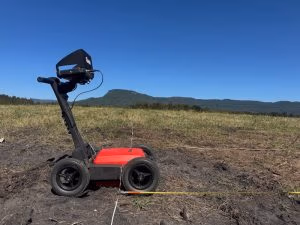
One of the greatest strengths of GIS lies in its ability to serve as a platform for the integration of heterogeneous data types. These can include excavation plans, aerial and satellite imagery, LiDAR datasets, geophysical survey results, historic cartography, and paleoenvironmental reconstructions. When brought into a GIS, these data types can be georeferenced and layered to identify correlations and trends, offering an integrative approach to archaeological interpretation.
For example, in their work on the landscape archaeology of the Faynan region in Jordan, Barker et al. (2007) used GIS to integrate satellite imagery, GPS-based field surveys, and environmental data to interpret ancient mining and agricultural systems. Similarly, the Portus Project in Italy employed 3D GIS models to reconstruct the imperial Roman harbour complex, integrating stratigraphic data, photogrammetry, and historical texts (Keay et al., 2011).
GIS-based visualisations, such as choropleth maps, 3D terrain models, and time-lapse animations, can effectively communicate findings to both academic and public audiences. These tools are vital not only for research dissemination but also for public engagement, digital heritage initiatives, and stakeholder collaboration (Dell’Unto, 2014).
Predictive Modelling and Survey Design
GIS plays a crucial role in optimising archaeological fieldwork through predictive modeling and survey design. Predictive models are built by correlating the spatial characteristics of known archaeological sites with environmental variables (e.g., elevation, slope, proximity to water), thereby identifying areas with high potential for undiscovered sites. These models can range from simple binary overlays to complex statistical or machine-learning-based algorithms.
Kvamme (1990) was an early proponent of this approach, demonstrating how GIS-based models could reduce time and cost in field surveys. More recent advances include the use of logistic regression, random forest, and Bayesian inference to improve model accuracy and transparency (Verhagen et al., 2020). These methods are widely applied in cultural resource management (CRM) to prioritise areas for investigation and minimise impact to protected sites.
In addition, GIS facilitates logistical planning for surveys and excavations. Terrain and hydrological modeling, landcover analysis, and viewshed simulations are invaluable for designing transects, selecting excavation areas, and interpreting the distribution of sites in relation to natural resources and strategic vantage points.
Heritage Management and Conservation
The utility of GIS extends beyond academic research into heritage management and conservation. By mapping archaeological sites and monitoring changes in land use, development, and climate, GIS provides heritage professionals with tools for risk assessment and strategic planning. For instance, the CyArk initiative uses GIS and 3D laser scanning to digitally preserve endangered heritage sites worldwide, documenting their spatial and architectural attributes in high resolution.
The Arches Project, developed by the Getty Conservation Institute and World Monuments Fund, uses open-source GIS to create inventories of cultural heritage resources for governments and NGOs (Myers et al., 2016). GIS has also been applied to monitor threats from sea-level rise and erosion in coastal heritage landscapes (Westley & McNeary, 2014).
Moreover, GIS supports community-based mapping initiatives that empower local and Indigenous groups to document and protect cultural sites. This participatory approach fosters ethical stewardship and acknowledges the cultural significance of landscapes beyond academic interpretations (Smith & Jackson, 2006). Incorporating traditional knowledge and Indigenous spatial ontologies into GIS platforms represents an important step toward decolonising digital heritage.
Challenges and Ethical Considerations
Despite its transformative impact, the application of GIS in archaeology raises important challenges. Data resolution and availability can limit analysis, particularly in regions where high-quality spatial data are restricted due to political or financial constraints. Furthermore, the proliferation of open-access data and cloud-based platforms necessitates robust protocols for managing sensitive information.
The digital publication of site locations, while useful for research transparency, may inadvertently expose vulnerable sites to looting or vandalism (Niccolucci & Hermon, 2002). This concern is especially acute for unexcavated or sacred sites known only to local communities. Ethical GIS use in archaeology requires careful management of sensitive information, consultation with Indigenous communities, and compliance with national heritage laws. Emerging best practices emphasise ethical data sharing, informed consent, and secure archiving of spatial data (Huvila, 2018).
The FAIR (Findable, Accessible, Interoperable, and Reusable) data principles must be balanced against the need for data security and cultural sensitivity. Archaeologists are increasingly engaging with digital ethics, spatial justice, and Indigenous data sovereignty to ensure that GIS technologies are used responsibly and inclusively.
Discussion
Geographic Information Systems have become indispensable to the field of archaeology, fundamentally changing how spatial information is collected, interpreted, and shared. By enabling spatial analysis, data integration, predictive modeling, and participatory heritage management, GIS enhances both the scientific depth and societal relevance of archaeological research. As technologies continue to evolve, archaeologists must remain vigilant in addressing ethical concerns while embracing the immense potential of GIS to map and protect our shared past.
References
- Barker, G., Gilbertson, D., & Mattingly, D. (2007). Archaeology and Desertification: The Wadi Faynan Landscape Survey, Southern Jordan. Oxbow Books.
- Conolly, J., & Lake, M. (2006). Geographical Information Systems in Archaeology. Cambridge University Press.
- Dell’Unto, N. (2014). The use of 3D models for intra-site investigation in archaeology. Internet Archaeology, (36). https://doi.org/10.11141/ia.36.5
- Huvila, I. (2018). Management of archaeological information and the epistemic culture of archaeology. Journal of the Association for Information Science and Technology, 69(10), 1236–1247.
- Keay, S., Millett, M., Paroli, L., & Strutt, K. (2011). Portus: An Archaeological Survey of the Port of Imperial Rome. British School at Rome.
- Kvamme, K. L. (1990). The fundamental principles and practice of predictive archaeological modeling. In A. Voorrips (Ed.), Mathematics and Information Science in Archaeology: A Flexible Framework (pp. 257–295). Holos.
- Llobera, M. (2003). Extending GIS-based visual analysis: the concept of visualscapes. International Journal of Geographical Information Science, 17(1), 25–48.
- Myers, D., Dalgity, A., & Avramides, I. (2016). The Arches heritage inventory and management system: A platform for the protection of cultural heritage. Journal of Cultural Heritage Management and Sustainable Development, 6(2), 213–224.
- Niccolucci, F., & Hermon, S. (2002). A semantic approach to cultural heritage digital archives. Computer Applications and Quantitative Methods in Archaeology (CAA).
- Smith, L., & Jackson, E. (2006). The ethics of heritage conservation: Community values and participatory methods. Heritage Studies Series.
- Verhagen, P., Nuninger, L., Groenhuijzen, M. R., & Bertoncello, F. (2020). Testing the robustness of archaeological predictive models with multi-agent simulations. Journal of Archaeological Method and Theory, 27, 612–642.
- Westley, K., & McNeary, R. (2014). GIS and predictive modelling in coastal archaeology. Journal of Maritime Archaeology, 9(1), 51–76.
- Wheatley, D., & Gillings, M. (2002). Spatial Technology and Archaeology: The Archaeological Applications of GIS. Taylor & Francis.