This page is designed to provide Aboriginal and Torres Strait Islander communities, archaeological professionals, and clients links to resources for geophysical/remote sensing data used in archaeology and heritage in Australia. The resources found on this page focus on GPR and magnetometry used to aid in identifying unmarked graves, with additional resources for other techniques and services we provide.
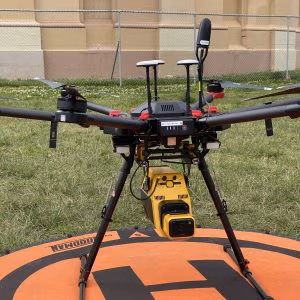
Additional techniques we employ range from multi-spectral, thermal, and LiDAR imaging using drones.
A number of excellent resources exist on the internet demonstrating the efficacy of GPR for aiding in re-identifying and locating unmarked graves and burials. Below are a few video examples explaining GPRs use, types of sensors, and benefits to communities.
GPR 101: The basics and how it’s used to locate unmarked graves -Webinar. Presented by Dr Kelsey Lowe for CIEHF.
Preparing for a Ground Search. Webinar of the National Advisory Committee on Residential Schools Missing Children and Unmarked Burials.
Best Practices in Remote Sensing for Grave Detection. Webinar in partnership with Tk̓emlúps te Secwépemc, the Canadian Archaeological Association and the Institute of Prairie and Indigenous Archaeology.
Beyond Ground Penetrating Radar: How other techniques can complement GPR and help in the search for residential school unmarked burials. Webinar of the National Advisory Committee on Residential Schools Missing Children and Unmarked Burials.
Calleja, J. F., Requejo Pagés, O., Díaz-Álvarez, N., Peón, J., Gutiérrez, N., Martín-Hernández, E., Cebada Relea, A., Rubio Melendi, D., & Fernández Álvarez, P. (2018). Detection of buried archaeological remains with the combined use of satellite multispectral data and UAV data. International Journal of Applied Earth Observation and Geoinformation, 73, 555-573. https://doi.org/10.1016/j.jag.2018.07.023
Conyers, L. B. (2017). Ground-Penetrating Radar and Magnetometry for Buried Landscape Analysis (1st 2018 edition. ed.). Springer International Publishing AG. https://doi.org/10.1007/978-3-319-70890-4
Geophysics for Practicing Geoscientists (2017), Geophysics for Practicing Geoscientists — GPG 0.0.1 documentation https://gpg.geosci.xyz/index.html
Goodman, D., & Piro, S. (2013). GPR remote sensing in archaeology (Vol. 9). Springer. https://doi.org/10.1007/978-3-642-31857-3
Lawrence B. Conyers, & Goodman, D. (1997). Ground-Penetrating Radar: An Introduction for Archaeologists . AltaMira. https://doi.org/10.1086/jar.54.3.3630660
Lowe, K. M., & Law, E. (2022). Location of historic mass graves from the 1919 Spanish Influenza in the Aboriginal community of Cherbourg using geophysics. Queensland Archaeological Research, 25, 67-81. https://doi.org/10.25120/qar.25.2022.3890
Lowe, K. M., Wallis, L. A., Pardoe, C., Marwick, B., Clarkson, C., Manne, T., Smith, M. A., & Fullagar, R. (2014). Ground‐penetrating radar and burial practices in western Arnhem Land, Australia. Archaeology in Oceania, 49(3), 148-157. https://doi.org/10.1002/arco.5039
Lowe, K. M., Williams, D., Wright, N., Gorringe, S., Gorringe, J., Andrews, I., Ustunkaya, M. C., Gorringe, B., & Westaway, M. C. (2023). Ula Thirra: a case study in the geomagnetic detection of combustion features in Channel Country of far south-western Queensland. Archaeological and Anthropological Sciences, 15(3). https://doi.org/10.1007/s12520-023-01722-7
Schmidt, Armin. 2004 Remote Sensing and Geophysical Prospection, Internet Archaeology 15. https://doi.org/10.11141/ia.15.9
Surveying and Mapping (2021), Surveying and Mapping – Open Textbook Library (umn.edu) https://open.umn.edu/opentextbooks/textbooks/surveying-and-mapping
Ground-penetrating radar (GPR) has become an invaluable tool in the non-invasive detection of unmarked graves and burials, particularly within Australia. The process involves meticulous research, precise design, and advanced data processing methods to ensure accurate results.
Research and Design Methods
Effective GPR surveys commence with thorough historical research to understand the site’s context. This includes reviewing burial records, maps, and oral histories to identify potential grave locations. Dr. Kelsey Lowe, an archaeologist and geophysicist at the University of Queensland, and Geophysical Director at Up & Under, emphasises the integration of oral histories with GPR technology to substantiate findings, noting that combining these approaches strengthens the case for identifying unmarked graves.
The design phase involves selecting appropriate GPR equipment and survey parameters tailored to the site’s specific conditions, such as soil composition and expected burial depths. Establishing a systematic grid pattern ensures comprehensive area coverage and facilitates accurate data collection.
Data Collection and Processing
During data collection, GPR devices emit radar waves into the ground, capturing reflections from subsurface structures. The collected data undergoes rigorous processing to filter noise and enhance the visibility of potential grave anomalies. Companies like Up & Under Services in Australia specialise in advanced digital solutions for archaeology and heritage management, offering expertise in GPR data collection and analysis.
Post-processing involves interpreting the refined data to identify anomalies indicative of unmarked graves. This requires expertise in recognizing patterns consistent with burial sites, such as soil disturbances or coffin-shaped reflections. The integration of GPR findings with other geophysical methods, like magnetometry and electrical resistivity, can further validate results.
Case Studies and Applications
In Australia, GPR has been instrumental in locating unmarked graves in various contexts. For instance, surveys at the Edenhope cemetery in Victoria revealed 67 possible unmarked graves, highlighting the technology’s efficacy in identifying previously unknown burial sites . Similarly, Dr. Lowe’s work with Indigenous communities has demonstrated the importance of combining scientific techniques with cultural knowledge to locate and memorialise unmarked graves.
The use of GPR in detecting unmarked graves exemplifies the synergy between technological innovation and cultural heritage preservation. Through meticulous research, thoughtful survey design, and sophisticated data processing, GPR serves as a crucial tool in uncovering and honoring previously hidden histories.
Processing ground-penetrating radar (GPR) data is a technically detailed task that benefits greatly from a foundational understanding of computer science. While proprietary software such as RADAN and GPR-SLICE offer point-and-click solutions, open-source alternatives are increasingly being used in archaeological and remote sensing applications due to their flexibility and accessibility. However, these open-source tools often require some programming knowledge to use effectively—particularly when dealing with large datasets, writing custom filters, or visualizing anomalies. For those looking to deepen their ability to interpret GPR results, investing time in learning the basics of programming can significantly improve both the quality and reliability of interpretations.
A great place to start is Harvard University’s CS50: Introduction to Computer Science, a free and widely respected course that covers fundamental programming concepts, algorithms, data structures, and problem-solving skills. This kind of training builds a strong base for working with the kinds of tools used in GPR processing, whether it’s scripting in Python or managing data in R. In fact, platforms like the Digital Archaeological Archive of Comparative Slavery (DAACS) offer targeted playlists such as Programming in R, specifically designed for archaeologists working with digital datasets. These resources not only empower users to process and visualize GPR data more confidently but also foster a deeper understanding of how and why certain patterns emerge in the data—leading to more nuanced and credible interpretations in burial and unmarked grave detection projects.
CS50: Introduction to Computer Science | Harvard University https://pll.harvard.edu/course/cs50-introduction-computer-science?delta=0
DAACS Programming in R https://www.daacs.org/research/playlists/doa-archives/doa-fall-2021/
At Up & Under Services, our experienced team is dedicated to supporting your next Ground-Penetrating Radar (GPR) or magnetometry project in Australia. Led by industry experts such as Dr. Kelsey Lowe, a renowned archaeological geophysicist with over 20 years of experience, and specialists in geospatial mapping and UAV photography, our team brings a wealth of knowledge to every project.
We offer advanced digital solutions tailored to archaeology and heritage management, including high-resolution subsurface imaging and detailed landscape modelling. By integrating technologies like GPR, magnetometry, LiDAR, and photogrammetry, we provide comprehensive insights that inform better decision-making and preserve cultural heritage. Our collaborative approach ensures that we work closely with clients to deliver precise, timely, and cost-effective results, making us your trusted technology partner in archaeological geospatial exploration.