Drones or uncrewed aerial vehicles (UAVs) have rapidly moved from niche technology to an essential tool across many disciplines. In heritage management and cultural heritage management planning, drones are now transforming how sites are recorded, monitored, and protected. Their ability to safely collect high-quality spatial data from above offers heritage professionals new ways to understand landscapes, structures, and cultural places that were previously difficult, time-consuming, or risky to document.
From vast archaeological landscapes to fragile historic buildings, drones provide a perspective that simply cannot be replicated from the ground. Below, we explore five key benefits of using drones in heritage management and why they are becoming indispensable for conservation, research, and planning.
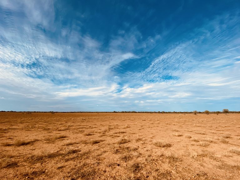
1. Aerial Surveying: Seeing the Whole Site at Once
One of the most powerful advantages of drones is their ability to conduct rapid aerial surveys. Heritage sites are often expansive, complex, and embedded within broader cultural landscapes. Traditional ground-based surveys can be slow and may miss spatial relationships that are only visible from above.
Drones allow heritage managers to:
- Quickly map large or remote sites
- Identify site boundaries, features, and patterns
- Assess storm, fire, erosion, or flood damage
- Detect previously unrecorded structures, pathways, or land modifications
An aerial perspective is particularly valuable for archaeological landscapes, where subtle changes in vegetation, soil colour, or topography can reveal buried features. By capturing the entire site in a single dataset, drones help managers make informed decisions about conservation priorities and future investigations.
2. 3D Modelling: Creating Digital Records for the Future
Imagery captured using a drone’s on board camera are often used to develop photogrammetric mosaics, the process of creating accurate 2D and 3D models from overlapping photographs. These models are far more than visual aids—they are precise digital records that can support long-term heritage management.
3D models allow heritage professionals to:
- Measure structures and features with high accuracy
- Plan conservation and restoration works
- Monitor gradual deterioration over time
- Preserve a digital record of sites at risk from climate change, development, or conflict
In addition, 3D models can be repurposed for education and interpretation. Virtual tours, interactive exhibits, and online access to heritage sites can significantly broaden public engagement, particularly where physical access must be restricted to protect fragile places.
3. High-Resolution Imaging: Capturing Details the Eye Misses
Modern drones are equipped with high-resolution cameras capable of capturing extraordinary levels of detail. This makes them invaluable for examining areas that are difficult or impossible to inspect safely from the ground.
High-resolution drone imagery can be used to:
- Identify cracks, weathering, or structural damage
- Examine rooflines, towers, cliffs, and façades
- Document rock art, carvings, or architectural ornamentation
- Support condition assessments without physical contact
For fragile heritage sites, especially those where human access could cause damage, drones provide a non-invasive way to gather critical information while minimising disturbance.
4. Reduced Risk: Improving Safety for Heritage Professionals
Heritage management often involves working in challenging and hazardous environments—unstable ruins, steep terrain, tall structures, or remote locations. Traditionally, documenting these areas required scaffolding, rope access, cherry pickers, or climbing, all of which carry significant safety risks.
Using drones dramatically reduces the need for:
- Working at heights
- Entering structurally unstable buildings
- Accessing hazardous or confined spaces
By keeping people safely on the ground, drones not only reduce the likelihood of injury but also lower insurance, equipment, and logistical costs associated with high-risk fieldwork.
5. Cost-Effective and Efficient Heritage Management
As drone technology has matured, it has become increasingly affordable and accessible. Compared to traditional surveying methods—such as manned aircraft, extensive scaffolding, or prolonged field campaigns—drones offer a highly cost-effective alternative.
Key efficiencies include:
- Faster data collection
- Reduced labour and equipment costs
- Rapid repeat surveys for monitoring change
- Streamlined integration with GIS and heritage databases
For heritage organisations working with limited budgets, drones enable high-quality documentation and monitoring that might otherwise be unattainable.
A New Standard for Heritage Conservation
Overall, drones provide heritage managers with powerful new ways to document, analyse, and protect cultural heritage. By combining aerial surveying, 3D modelling, high-resolution imaging, improved safety, and cost efficiency, UAVs support more informed, accurate, and sustainable conservation efforts.
As heritage sites face increasing pressures from climate change, urban expansion, and natural disasters, the ability to rapidly capture detailed, non-invasive data is more important than ever. Drones are no longer just an emerging technology in heritage management—they are becoming a standard tool for safeguarding the past while planning for the future.
When used responsibly and in collaboration with communities, regulators, and cultural custodians, drones offer a way to honour, preserve, and share heritage in ways that were unimaginable just a decade ago.