Drones can help preserve archaeological sites by minimizing the need for physical access to the site, while also improving safety.
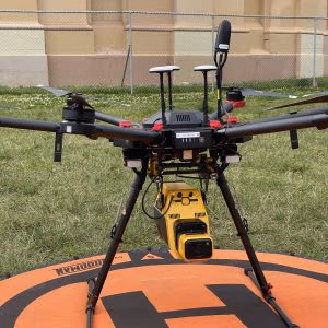
Unmanned Aerial Vehicles (UAVs) or drones are increasingly being used in archaeology to survey, map, and document archaeological sites. These aerial vehicles offer several benefits over traditional surveying methods, making them an attractive option for archaeological research. Let’s explore the benefits of using UAV technology for archaeology.
High-Resolution Imagery
UAVs equipped with high-resolution cameras can capture detailed imagery of archaeological sites from different angles and altitudes. This imagery can be used to create highly accurate maps and 3D models of the site, allowing archaeologists to better understand the site’s layout, topography, and features. This information is invaluable in understanding the site’s history, function, and development.

Access to Inaccessible Areas
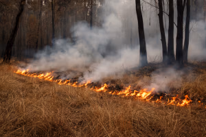
UAVs can access areas that are difficult or impossible for humans to reach. Archaeological sites can often be located in remote or challenging terrain, such as mountains, deserts, or dense forests, making access difficult for humans. Drones can fly over and capture images of these areas without disturbing the site, providing access to inaccessible regions and saving time and effort for archaeologists.
Preservation of Sites
UAVs can help preserve archaeological sites by minimizing the need for physical access to the site. Traditional surveying methods can involve walking or driving over the site, which can cause damage to fragile structures or artifacts. Drones can capture images from a distance without disturbing the site, reducing the risk of damage to the site and its contents.
Cost-Effective
Using UAVs for archaeological research can be cost-effective compared to traditional surveying methods. Traditional methods often require a team of archaeologists to physically access and survey the site, which can be time-consuming and expensive. UAVs can cover large areas in a short amount of time, reducing the overall cost of the project. Additionally, drones can be used repeatedly to monitor changes in the site over time, providing more information without additional costs.
Safety
UAVs can improve safety in archaeological research by reducing the need for humans to access dangerous areas. Archaeological sites can be located in hazardous environments, such as cliffs or steep slopes, where the risk of accidents is high. Using drones can reduce the need for human access to these areas, thus reducing the risk of accidents and injuries.
Data Analysis
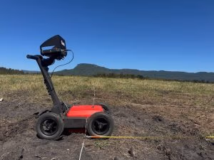
UAVs can collect large amounts of data that can be analyzed in detail to reveal insights into the site. This data can include high-resolution imagery, 3D models, and thermal imaging, which can provide valuable information about the site’s structures, features, and environmental conditions. This data can be used to create detailed reports and presentations, which can help archaeologists communicate their findings to a broader audience.
UAV technology has revolutionized archaeology by providing archaeologists with access to inaccessible areas, high-resolution imagery, and cost-effective surveying methods. Drones can help preserve archaeological sites by minimizing the need for physical access to the site, while also improving safety for archaeologists. The data collected from UAVs can be used to create detailed maps and 3D models of the site, providing valuable insights into the site’s history, function, and development. As drone technology continues to advance, it is likely that UAVs will become an increasingly important tool for archaeological research.