The Basics of Drone Photogrammetry

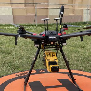
Conducting photogrammetry using a drone is an excellent way to create high-quality 3D models of an object or a space.
Blog background Up & Under
Photogrammetry is a technique that is used to create 3D models of an object or a space by taking a series of photographs from different angles. A drone is an excellent tool to conduct photogrammetry as it allows you to capture high-quality aerial photographs and videos of the target area from a bird’s-eye view. In this article, we will discuss how to conduct photogrammetry using a drone.

Step 1: Plan your mission

The first step in conducting photogrammetry using a drone is to plan your mission. You need to determine the area you want to capture, the altitude you want to fly your drone, and the flight path you want to take. You can use various software to plan your mission, such as DroneDeploy, Pix4D, and Map Pilot.
Step 2: Prepare your drone

The next step is to prepare your drone for the flight. Make sure that your drone’s battery is fully charged, and the propellers are correctly attached. You also need to check the camera settings, such as the exposure and focus, and set them according to the lighting conditions and the target area.

Step 3: Conduct a test flight

Before conducting the actual photogrammetry flight, you need to conduct a test flight to ensure that your drone is working correctly, and the camera settings are optimal. You can fly your drone over a small area and take some test shots to check the image quality and the camera settings.

Step 4: Fly your drone

Once you have completed the test flight, you can start the photogrammetry flight. Make sure that you fly your drone in a steady and controlled manner to ensure that you capture high-quality images. You can use the software to control the drone’s flight path and take pictures automatically.

Step 5: Process the images

After you have completed the photogrammetry flight, you need to process the images to create a 3D model of the target area. You can use various software to process the images, such as Pix4D, Agisoft Metashape, and OpenDroneMap. The software will use the images to create a point cloud, which is a 3D representation of the target area. The point cloud can then be used to create a 3D model of the area.

Step 6: Analyze the data

Once you have created a 3D model of the target area, you can analyze the data to extract useful information. For example, you can use the 3D model to measure the volume of a stockpile, calculate the area of a field, or create a 3D map of a construction site. Conducting photogrammetry using a drone is an excellent way to create high-quality 3D models of an object or a space. However, it requires careful planning, preparation, and execution to ensure that you capture accurate and useful data. By following the steps outlined above, you can conduct photogrammetry using a drone successfully.

Share:

New White Paper

Download your copy of our 2026 White Paper: Demystifying Remote Sensing for Heritage & Landscape Intelligence

More Posts

Beyond the Pale Blue Dot.

The fascination Homo sapiens have had and continue to have with the cosmos is evidenced the world over and across civilisations through space and time. From a circa 2,500 BCE stone arrangement on the Salisbury Plains in England to the painted cave walls and ceilings of celestial and spiritual beings connecting people, land, and sky found throughout Aboriginal Australian cave art our obsession with the cosmos has spanned tens of millennia.

Fire-stick farming or cultural burning

Connection to Country through the practice of cultural burning

“In recent years there has been increasing interest in the effect of man on the Australian environment. Forests have been bulldozed, swamps drained, heaths sown with trace elements, beaches chewed up, and the litter of the mid-twentieth century spread everywhere. That this is deeply affecting the countryside is obvious to all and causes concern to some” (Jones, 1969).

A Layered Landscape with a Complex History

Rather than relying solely on traditional methods, there is increasing recognition of the value of non-invasive technologies that can provide depth, context, and clarity simultaneously.

Send Us A Message