There are many advantages of using ground-penetrating radar (GPR) in archaeological investigations in Australia. As a non-destructive geophysical technique, GPR has revolutionised archaeological exploration by offering high-resolution subsurface imaging capabilities. The unique environmental and geological characteristics of Australia present both challenges and opportunities for archaeological research, making GPR an invaluable tool for uncovering hidden cultural heritage sites. The Up & Under team can provide an array of existing literature and case studies, and this post elucidates the significant contributions of GPR to Australian archaeology, including its ability to detect buried features, enhance site mapping, and inform cultural resource management strategies.
Archaeology in Australia presents distinctive challenges due to its vast and diverse landscapes, ranging from arid deserts to dense rainforests. The preservation of archaeological sites is influenced by factors such as soil composition, climate variability, and indigenous cultural practices. Traditional excavation methods are often invasive and time-consuming, posing risks to delicate cultural remains and the surrounding environment. In this context, the adoption of non-invasive techniques like GPR has become increasingly prevalent, offering a non-destructive means of subsurface exploration.
Principles of Ground-Penetrating Radar
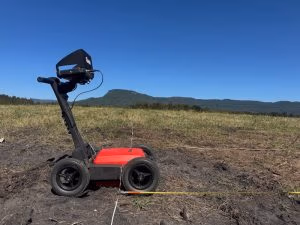
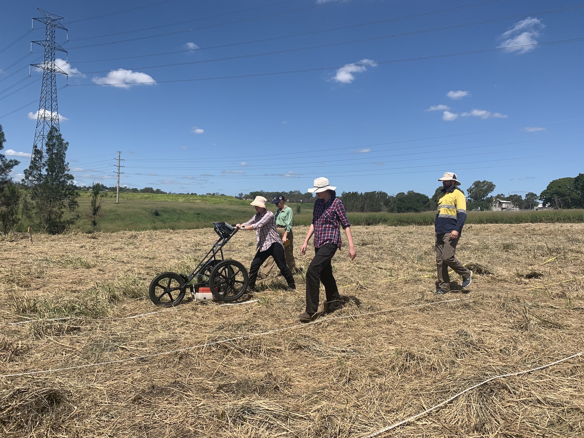
Ground-penetrating radar (GPR) operates on the principle of emitting electromagnetic pulses into the ground and recording the reflected signals. Variations in subsurface materials, such as soil layers, rocks, and archaeological features, alter the velocity and amplitude of these signals, allowing for the creation of detailed subsurface images. GPR systems consist of a transmitter antenna that emits the radar signal and a receiver antenna that detects the reflected waves, enabling the reconstruction of subsurface structures with high spatial resolution.
Detection of Buried Features
One of the primary benefits of GPR in Australian archaeology is its effectiveness in detecting buried features without the need for excavation. In environments where surface visibility is limited, such as dense vegetation or sand dunes, GPR can penetrate the subsurface to reveal hidden archaeological remains. Studies have demonstrated the capability of GPR to identify features such as ancient hearths, burial sites, and structural foundations, providing valuable insights into past human activities and settlement patterns.
Enhanced Site Mapping
GPR facilitates the creation of detailed site maps by delineating subsurface features with precision. In Australian landscapes characterised by complex geological formations and varying soil types, GPR data can supplement traditional survey methods, enabling archaeologists to produce comprehensive site maps with minimal disturbance to the environment. Integrating GPR results with geographic information systems (GIS) enhances spatial analysis and allows for the visualisation of archaeological features within their environmental context.

Cultural Resource Management
The application of GPR in cultural resource management (CRM) has profound implications for heritage conservation and preservation in Australia. By accurately mapping archaeological sites and assessing their subsurface integrity, GPR helps inform decision-making processes regarding land use planning, infrastructure development, and heritage protection measures. In regions subject to development pressures or environmental threats, GPR serves as a proactive tool for identifying and safeguarding culturally significant sites before they are compromised.
Case Studies
Several case studies exemplify the efficacy of GPR in Australian archaeology. In Kakadu National Park, GPR surveys have revealed extensive Aboriginal occupation sites dating back thousands of years, shedding light on ancient settlement patterns and cultural practices. Similarly, GPR investigations in Tasmania have uncovered hidden convict-era structures beneath vegetation cover, enriching our understanding of colonial history in the region. These examples underscore the transformative impact of GPR on archaeological research and heritage management across diverse Australian landscapes.
Ground-penetrating radar represents a valuable asset in the toolkit of Australian archaeologists, offering unparalleled capabilities for subsurface exploration and site mapping. By harnessing the non-invasive nature of GPR technology, researchers can uncover hidden cultural heritage sites while minimising disturbance to the surrounding environment. As archaeological investigations continue to evolve in response to emerging technologies and research methodologies, GPR remains a cornerstone of modern exploration practices, shaping our understanding of Australia’s rich cultural heritage.